South Pass, Oregon Buttes & the Green River
📍 South Pass to Green River, WY
Another early start — but a stop for coffee (me), tea (Keith), a scone (Keith), and a piece of coffee cake (me 😋).
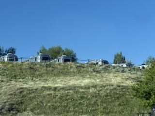
As we drove out of town, we saw other Airstreamers who hadn’t gotten in line to leave….
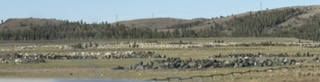
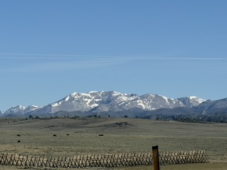
Down the road we go… I keep seeing these large boulders lined up like walls in a field. And looking to the west, I see there is snow in the Rockies!
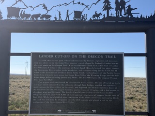
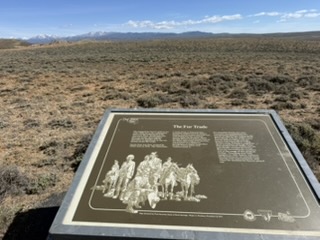
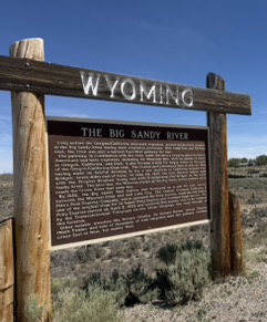
Lander Cutoff
At the Lander Cutoff, we found this lovely sign — about the only road the federal government supported for emigrant movement.
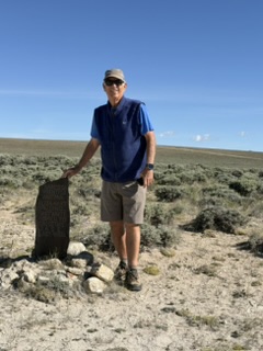
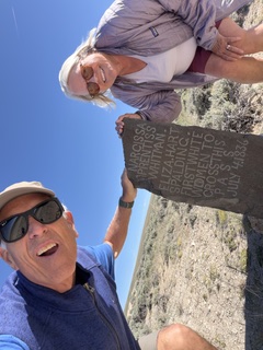
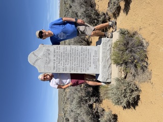
Yesterday’s Hike — Narcissa Whitman & Eliza Spaulding
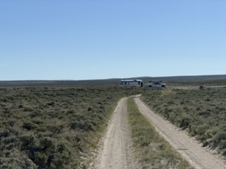
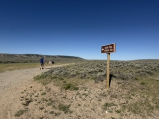
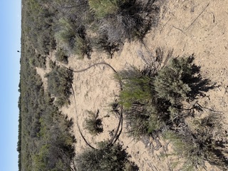
Yesterday, our friend Doug found a marker he knew Keith had to see in person. So we drove down a dirt and gravel road, over two cattle guards, and parked by a secondary road to hike in to see the marker. Hiking out about 0.8 miles, we passed three markers.
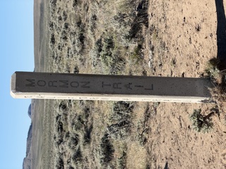
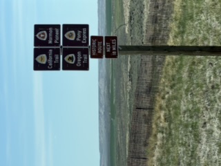
We spotted a hint — the historic trail sign. Then, a familiar sight: a four-sided granite post with Oregon Trail, California Trail, Mormon Trail, and Pony Express Trail on it.
And then we found it! A marker with acknowledgement of Narcissa Whitman and Eliza Spaulding’s part in history.
A hike back to the truck and trailer, and Keith used the wide spot in the road to turn around. We continued on to check things off the list he creates for every trip between new campsites.
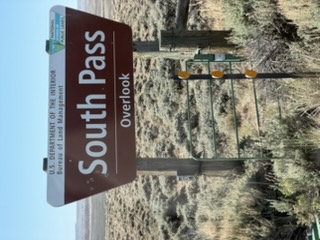
South Pass Overlook
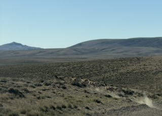
We paused at the South Pass Overlook to check it out. We have seen a lot of antelope. Here is a group we encountered when driving down the county road.
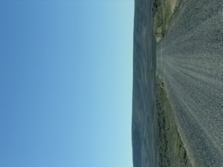
South Pass is a 20-mile-wide, gently sloping gap in the Rocky Mountains. It provided a good wagon route for travelers on the Oregon Trail, California Trail, Mormon Trail, and the Pony Express.

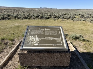
Oregon Buttes
Another historic landmark was the view of the Oregon Buttes. This sight roughly marked the emigrants’ entry into the Oregon Territory.
The “False” Parting of the Ways
We stopped to look at a spot nicknamed the “false” Parting of the Ways. Further down the trail, parties would split and go north to Utah, south to California, or west to Oregon. This spot did divide the emigrants — some went southwest to Fort Bridger (where we were headed) and some took the Sublette Cutoff heading directly west.
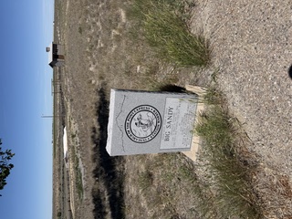
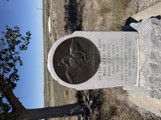
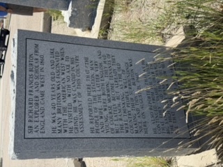
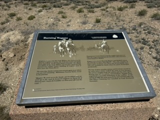
Big Sandy Pony Express Station
One of the Pony Express stations — mostly destroyed — was on the Big Sandy River. There is a pullout to view the remains, but it sits on private property. Some of the info was about a “Sir Richard Burton” — not the one that comes to mind first…
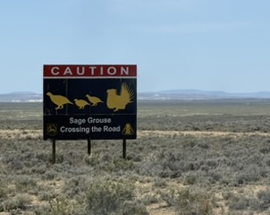
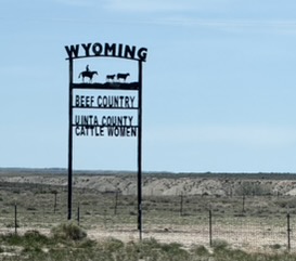
Wyoming Highways
As we rolled along the Wyoming highways, we saw these signs:
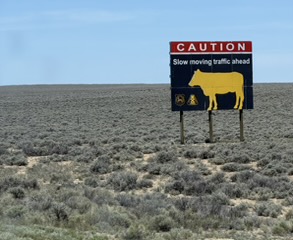
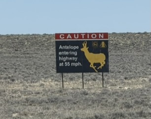
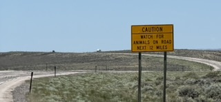
We saw one antelope come up to the highway but it didn’t cross — and we saw it in time to slow waaaay down.
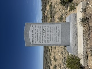
Simpson’s Hollow
At Simpson’s Hollow, we found an interesting story about separation of church and state. Brigham Young was the head of a religious sect but he also claimed to be the governor of Utah. President Buchanan appointed a new governor but, fearing Utah’s citizens might not accept him, he canceled mail service to the territory and sent 2,500 troops to deliver the news. Not knowing what the incoming troops’ purpose was, Brigham Young — thinking they were there because of religious persecution — sent the Utah Militia out. The militia attacked the troops.
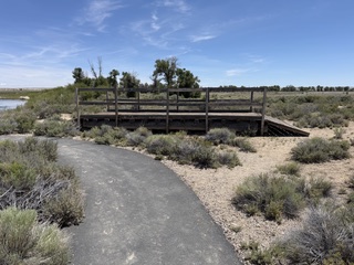
Green River Ferry
Along the Green River, we found a ferry built in the 1990s to recreate what the settlers may have done to move their wagons across the river. The river is also called the Seedskadee — “Prairie Chicken River” — by the Shoshone people. It is now a wildlife preservation area. Mormons with handcarts could pull their carts across the river in certain areas where it was low.
Wagons could load onto the raft (ferry) and they used a cable — maybe it was a rope back in the day — to pull them across from the other side. Some emigrants “waterproofed” their wagons to be able to float better when fording rivers.
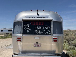
Slogan Paint
Our leaders brought white “paint” to write an appropriate slogan on the back window of our rigs. Here’s one that came out.
“The preservation of parks, wilderness and wildlife has also aided liberty by keeping alive the 19th century sense of adventure with which our forefathers greeted the American West. Many laws protecting environmental quality have promoted liberty against the destructive trespass of pollution. In our own time, the nearly universal appreciation of preserved landscapes, restored waters, and cleaner air through outdoor recreation is a modern expression of our freedom and leisure to enjoy the wonderful life that generations past have built for us.”
— Ronald Reagan